Dangerous severe weather, tornado outbreak to continue for 3rd day in central US
The number of severe thunderstorms and tornadoes will increase over the central United States with dangerous conditions to focus on portions of the Ohio, Tennessee and mid-Mississippi valleys into Wednesday night, AccuWeather meteorologists warn. The significant risk to lives and property will continue.
As of daybreak Wednesday, there were close to 500 preliminary reports of severe weather since the start of Monday, which encompasses tornadoes, high winds and hail. Of these there have been nearly 50 reports of tornadoes. Perhaps the strongest tornado of the outbreak thus far -- an EF4 -- hit Bansdall, Oklahoma, on Monday evening with winds estimated up to 200 mph. The multiday outbreak has claimed the life of one person and injured several others.
 |
The midweek severe weather has the potential to be the biggest day (and night) in terms of impact and the number of incidents ranging from tornadoes to damaging winds and hail.
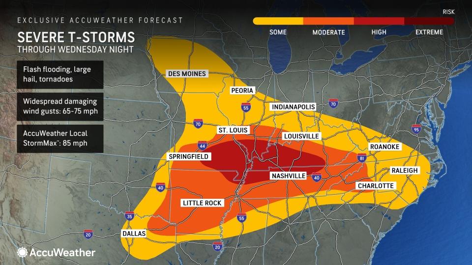
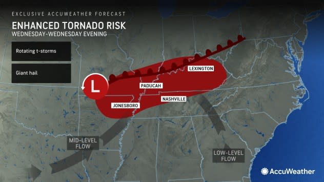
AccuWeather has highlighted a high-risk area into Wednesday night, where widespread severe weather and tornadoes have been anticipated for many days in advance.
The high-risk zone extends from southeastern Missouri and northeastern Arkansas through southern Illinois, western and central Kentucky and northwestern and middle Tennessee.
One key aspect affecting impact is that the severe weather and tornado potential will focus on more densely populated areas than the Great Plains. At least 75 million people are at risk of experiencing severe weather into Wednesday night from the Central states to parts of the East.
GET THE FREE ACCUWEATHER APP
•Have the app? Unlock AccuWeather Alerts™ with Premium+
"There could easily be over a dozen tornadoes produced at midweek alone," AccuWeather Chief On-Air Meteorologist Bernie Rayno warned.
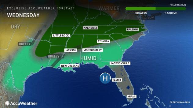
Severe weather is expected to reach outward from the bull's-eye, which will be around the confluence of the Ohio and Mississippi rivers, northward to the Interstate 70 corridor of the Midwest, eastward to the Carolina coast and southwestward to northeastern Texas.
 |
Major cities at risk of severe weather into Wednesday night include Nashville and Memphis, Tennessee; Louisville and Paducah, Kentucky; Cincinnati; Evansville, Indiana; St. Louis and Cape Girardeau, Missouri; Little Rock and Texarkana, Arkansas; Springfield, Illinois; and Dallas.
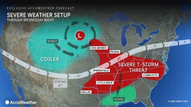
The key factors behind the midweek severe weather threat are a strong jet stream overhead, a warm front and plenty of moisture.
"This high-risk tornado and large hail zone stretches along where a warm front will lift slowly northward," Rayno said, "Warm fronts are notorious for producing tornadoes and large hail in this setup." A warm front represents the back edge of retreating cool air.
 |
Should this zone be free of clouds and downpours for several hours during the afternoon and evening, that could be enough to trigger powerful, discrete thunderstorms. These types of storms often develop rotation, which can trigger tornadoes.
It is possible for any tornado that forms in the lower Ohio, Tennessee and mid-Mississippi valleys to become strong and on the ground for more than a few minutes. The longer the tornado is on the ground, the greater the chance of it coming in contact with homes, farms and businesses.
There can be a significant risk to lives and property even where tornadoes do not touch down. Powerful straight-line wind gusts are much more common in severe thunderstorms than tornadoes. These winds reaching hurricane force (74 mph or greater) can uproot trees, break large tree limbs and damage roofs. Some storms can also pack hailstones the size of golf balls and baseballs, which can break windows, damage vehicles severely and destroy newly planted crops.
 |
Flash flooding is one of the leading causes of weather-related fatalities, and there is a large area at risk of flooding due to the widespread nature of the thunderstorms through Wednesday night.
"How intense some of the storms become will depend on the number of competing showers and thunderstorms in the first place," AccuWeather Long-Range Meteorologist Paul Pastelok said. "Because of the large number of storms producing torrential downpours, which can repeat for several hours, this setup has the potential to produce flash flooding on par with the severe weather."
Some locations in the Ohio and Tennessee valleys may be hit by downpours for three days in a row by Thursday, which is the final day of the outbreak for part of the region.
Portions of Kentucky, Tennessee and southern Missouri may receive 2-4 inches of rain and locally higher amounts from the repeating rounds. Much of that rain could fall in a few hours.
In the wake of the severe weather into Thursday in part of the Midwest, a pattern much less conducive for widespread outbreaks will settle in for much of the rest of May. However, there will still be smaller disturbances capable of producing more localized severe weather and perhaps a couple of tornadoes to contend with every few days.
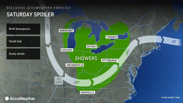
One such disturbance will drop southeastward from central Canada on Friday over the Upper Midwest and pivot toward the Ohio Valley on Saturday.
 |
Showers and embedded thunderstorms, some packing gusty winds and small hail, will erupt as the system moves along. Any downpours could disrupt outdoor plans on Mother's Day weekend.
Want next-level safety, ad-free? Unlock advanced, hyperlocal severe weather alerts when you subscribe to Premium+ on the AccuWeather app. AccuWeather Alerts™ are prompted by our expert meteorologists who monitor and analyze dangerous weather risks 24/7 to keep you and your family safer.


