Potentially damaging frosts and freezes coming to Midwest, Northeast
 |
Temperatures well above the historical average from the winter through early spring may have offered some comfort to consumers through lower heating bills. However, AccuWeather meteorologists say there are some concerns the warmth will raise the risk of damaging frosts and freezes in the Midwest and Northeast before the end of April.
Temperatures since Dec. 1 have averaged 6-8 degrees Fahrenheit above the historical levels in the Midwest while most locations in the Northeast have been 3-6 degrees above typical levels. The Great Lakes experienced historically low ice cover levels during the late winter -- at a time when ice cover typically reaches a maximum of 53% on average. The Great Lakes were nearly ice-free in late February and March.
The lack of frozen lakes and long-lasting snow in the northern tier of the Midwest took its toll on winter sports activities ranging from ice fishing and snowmobiling to people who rely on winter road and property maintenance for income. AccuWeather experts estimate that the lack of winter cold cost the region around $8 billion in losses.
In an interesting twist, there is the potential for more costly problems, this time due to chilly weather, in the near future, not only for the Upper Midwest but also the Northeast.
In recent weeks, winter has stirred just a bit to produce some impressive late-season snowfalls and quick shots of chilly air. A pair of storms dropped feet of snow on northern New England from late March to early April. Snowstorms returned to the Upper Midwest during the same time after being absent much of the winter.
 |
"There are going to be plenty of cool fronts swinging from the northern Plains into the first half to two-thirds of May," AccuWeather Lead Long-Range Meteorologist Paul Pastelok said.
"Not every push of chilly air will make it to the coastal Northeast," Pastelok added, "However, some will and the ones before May are of the most concern."
While back-and-forth warm and chilly episodes are typical of spring, it is the lack of consistent cold during the winter and early spring that has bud break, blossoming and leaf-out well ahead of the historical average in the Midwest and the Northeast.
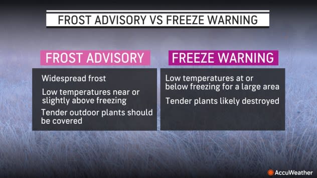
This raises the stakes for damage should a freeze or frost occur -- and there are some on the way, AccuWeather meteorologists warn. Keep alert for frost advisories and freeze warnings in the coming days, which will be issued by local National Weather Service offices.
 |
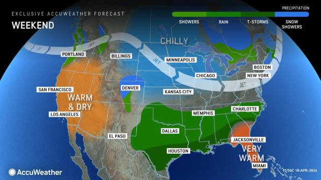
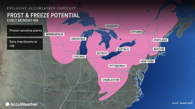
Low temperatures in the 30s will be common from the Midwest to the interior Northeast. A few colder locations will drop into the 20s.
Where skies are clear and winds drop off, the dry air will allow temperatures to plummet near the ground, and a frost or freeze can occur that could potentially damage sprouting vines and blossoming fruit trees.
For example, Kalamazoo, Michigan, is located near the heart of the Lower Peninsula of Michigan's wine country and will have multiple nights with low to middle temperatures in the 30s from late this week through this weekend. A breeze may stir during most nights and prevent frost. However, on a night when winds drop off, frost may form.
 |
Farther to the east, Elmira is located in a valley stretching across central New York's southern tier, just south of the Finger Lakes vineyard country. Elmira is forecast to drop to within a few degrees of freezing at night from Saturday night to Monday night.
"An even colder high-pressure area is currently on deck for the middle to the latter part of next week," AccuWeather Meteorologist Brandon Buckingham said.
 |
Temperatures may be several degrees lower at the pit of the cold wave next week, which will increase the risk of damage in many of the same areas as this weekend and bring the danger to some areas that escaped the first round.
Temperatures along the major Interstate 95 cities will drop into the 40s, so rooftop gardens and those in urban areas should be safe from a freeze. However, temperatures may dip to frosty levels in some of the suburbs in both cold shots.
 |
Across the Midwest and the interior Northeast, vineyard and orchard operators may want to evaluate the state of the budding and blossoming and possibly take preventative measures where feasible. Those with flower and nursery stock, including home improvement vendors, may need to cover or move stock under cover during the coldest nights.
The risk of damaging frosts should lower during May.
"A major warmup is coming before the end of April," Pastelok said, "The pattern moving forward during May should be nothing out of the ordinary. We expect some brief cooldowns, but temperatures will average above historical levels during the month ahead."
Any frost potential in May is likely to be marginal and highly localized.
It's not just the Midwest and Northeast of the United States where cold air shots may be problematic.
"Similar chilly conditions are likely in western and central Europe through late next week," AccuWeather Lead International Meteorologist Jason Nicholls said.
Some areas have experienced their warmest winter on record. In much of France, temperatures from Dec. 1 through April 17 have averaged 5 F above historical levels. The warmth that followed a brief chilly episode from early April has pushed temperatures to 5-10 F above average this month and has further advanced bud break, sprouting and blossoming.
 |
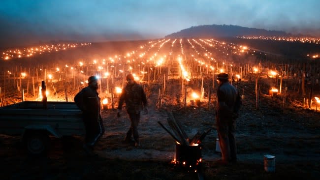
Winegrowers warm themselves around a fire as anti-frost candles burn in a vineyard to protect blooming buds and flowers from the frost, in Chablis, Burgundy region, Monday, April 4, 2022. Plunging April temperatures around France are threatening vineyards and other important crops. Vintners are scrambling to find ways to protect the vines from the frost, which comes after an unusually mild winter and is hitting countries around Europe. (AP Photo/Thibault Camus) |
While clouds and breezes may limit the extent of frosts and freezes, there is the potential for a couple of nights when skies become clear, winds drop off and temperatures plummet in parts of the vineyard and orchard areas, including in France, Germany and Spain.
An outbreak of Arctic air in mid-January that was preceded by long-term mild conditions caused major damage to vineyards in the Okanagan Valley of British Columbia, Canada. Initial damage was estimated to result in a loss in local production of 94-99% for 2024, according to Wines of British Columbia.
Want next-level safety, ad-free? Unlock advanced, hyperlocal severe weather alerts when you subscribe to Premium+ on the AccuWeather app. AccuWeather Alerts™ are prompted by our expert meteorologists who monitor and analyze dangerous weather risks 24/7 to keep you and your family safer.


