Powerful storms fire up in the Midwest with large hail and tornadoes

A powerful storm system is spinning up tornadoes, unloading hail and sending damaging wind gusts over parts of the Mississippi Valley and Midwest Tuesday.
Tornado reports were made in at least 10 counties across Nebraska, Iowa, Missouri and Kansas on Tuesday, according to the National Weather Service.
One of the reported tornadoes tore a nearly 7-mile path through Dallas County, Iowa, destroying a handful of agricultural buildings and doing minor damage to residences and land, the local emergency management office said.
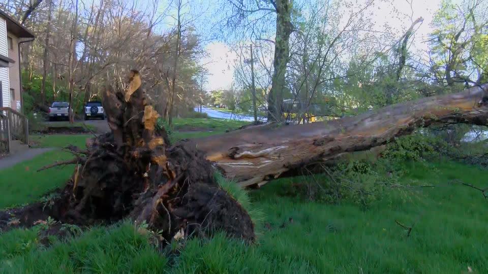
Numerous large trees were snapped and uprooted and a farm outbuilding was ripped from its foundation when two tornadoes roared through Greenwood County, Kansas, early Tuesday, the weather service in Wichita said.
Further east, an EF-1 tornado touched down around Smithville, Missouri, Tuesday morning, tearing off roof coverings and partially collapsing the wall of at least one building, according to a social media post from the weather service in Kansas City.

Storms were expected to expand in scope and strength through Tuesday evening and place millions at risk of severe weather from Minnesota and Wisconsin to Arkansas and Tennessee.
Any of Tuesday’s storms could feature hail, strong winds or tornadoes, but the most significant hail and tornado threat includes Iowa, northern Missouri and west-central Illinois. An “enhanced,” or level 3 of 5, risk for severe thunderstorms covered this area, which includes Des Moines and Cedar Rapids, Iowa, for much of Tuesday, according to the Storm Prediction Center.
Storms could produce hailstones the size of baseballs and strong tornadoes – EF2 strength or greater – in this region, especially during the afternoon and evening hours, the center said.
A larger portion of the Midwest had a slight, or level 2 of 5, risk for severe thunderstorms Tuesday, the prediction center said.
Pockets of heavy rainfall may also trigger flash flooding in parts of the northern Plains and Mississippi Valley, even outside of the areas that experience severe thunderstorms. Rainfall totals could reach 3 inches and fall at rates of 1 to 2 inches per hour in some places.
Fort Wayne, Indiana, and Milwaukee have already received a surplus of rain this month, with more than a dozen river gauges already at minor flood stage even before this round of rain. More rain could overwhelm rivers and streams and lead to flash flooding.
Storms will track farther east on Wednesday and bring a new round of severe thunderstorms from the Great Lakes and Ohio Valley to as far south as Tennessee and Arkansas. Soaking rain will also fall in the Northeast.
All hazards – including hail, damaging winds and tornadoes – are possible on Wednesday in parts of Michigan, Indiana, Ohio and Kentucky.
On Thursday, another round of storms is set to sweep from Texas to Ohio.
“Scattered strong to severe storms capable of damaging winds, large hail, and perhaps a couple tornadoes will be possible Thursday from parts of eastern Missouri into the lower Ohio Valley and vicinity,” warns the Storm Prediction Center.
Elevated fire risk in some states
Gusty winds accompanying the storms are contributing to a widespread elevated risk of fire across the Southwest through Wednesday morning.
Red flag warnings are active Tuesday in New Mexico, Texas and parts of Colorado. They are also in place in northeast Montana.
Strong winds, combined with low humidity and brittle brush, could fuel the rapid spread of any fires that may ignite in the warning area, the National Weather Service said. People should take care to avoid activities that may spark fires.
Simple fire prevention measures include properly discarding cigarettes, keeping cars off of dry grass, avoiding creating open flames or sparks, and obeying burn bans, the weather service in Albuquerque, New Mexico, advised.
For more CNN news and newsletters create an account at CNN.com


