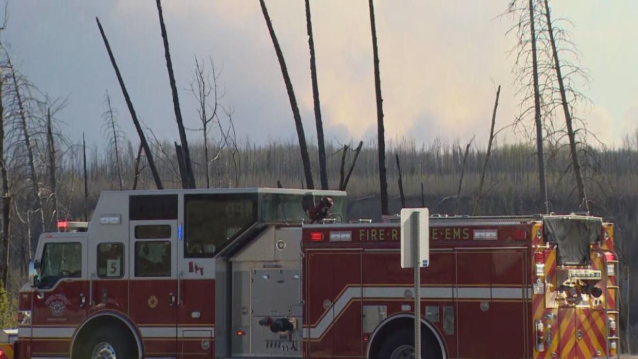
Wildfire near Fort McMurray grows to 5,500 hectares but flames pushed south of city

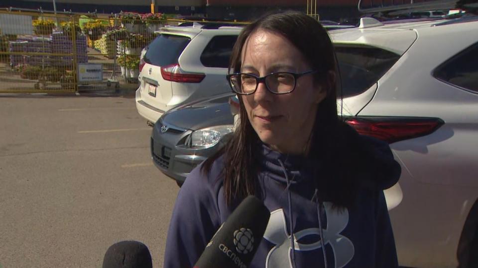
Richelyn Fabian, a Fort McMurray, Alta., resident of 17 years, and her family are trying to live as normal as possible — even going to the park. But she has ensured her four children have packed overnight bags and that dry goods and water are stocked at home.
The Regional Municipality of Wood Buffalo is under an evacuation alert due to a wildfire burning 16 kilometres southwest of Fort McMurray, in northwestern Alberta. Residents don't have to leave, but they must be ready to.
For Fabian, the situation conjures memories of the 2016 wildfire. That fire, dubbed 'The Beast', forced more than 90,000 people to evacuate the region and destroyed 2,400 homes and businesses. It is the second-most costly Canadian disaster on record, according to the federal disaster database.
"It sucks to be in this situation again," Fabian told CBC News on Saturday.
"This is Mother Nature. There's nothing, really, we can do so much. So just prepare and stay on alert."

Richelyn Fabian, a Fort McMurray, Alta., resident, is making sure her family is prepared to evacuate due to wildfire. She works with seniors, she said, and has also helped them prepare. (Nathan Gross/CBC)
Alberta Wildfire is reporting 49 total active wildfires as of 3:15 p.m. MT Sunday, including seven mutual aid fires. The mutual aid designation occurs when Alberta Wildfire is helping with firefighting but it is not the lead agency.
Environment and Climate Change Canada has issued air quality statements for most of Alberta, mainly due to wildfire smoke emanating from northeastern B.C. Some areas are affected by local wildfires.
Two wildfires in Alberta are deemed out of control, including the one burning near Fort McMurray, which more than tripled in size overnight.
The fire is about 5,500 hectares, Alberta Wildfire estimated. On Saturday morning, it was about 1,500 hectares.
Fire officials witnessed extreme wind speeds and fire behaviour Saturday, but the flames were pushed to the southeast, away from the community, said Melissa Story, an Alberta Wildfire public information officer.
"Now, it's skipping the south portion of the city and heading in a southerly direction," Story said while on CBC Radio's Daybreak Alberta Sunday morning.
Although the fire grew significantly over 24 hours, Story said overnight firefighting was successful on the northeast portion of the wildfire.
Alberta Wildfire does not expect the fire to grow much on Sunday, as winds are forecast to slow down and shift northwesterly, pushing the flames onto the current burned area, Story said.
The fire was heading toward Highway 63, but the change in wind direction stopped that, said Josee St-Onge, another Alberta Wildfire public information officer. The fire is about 12 kilometres from the highway.
Sunday's focus will be on the southeast side, Alberta Wildfire officials told CBC News. Six firefighting crews and 13 helicopters are being deployed. An incident management team is being added to the fold Sunday, and air tankers are available if needed.
Heavy equipment groups will continue working to establish a fire guard in the northeastern part of the fire, St-Onge said.
The regional municipality of Wood Buffalo — including Fort McMurray, Fort McMurray First Nation, Anzac, Saprae Creek and Gregoire Lake estates and Rickards Landing Industrial Park — is still under an evacuation alert.
Julia Soucie is among the residents making sure they're ready to evacuate, should the alert escalate to an evacuation order.

Julia Soucie feels better prepared for the current wildfire situation after having gone through the 2016 wildfire, which forced more than 90,000 people to evacuate the region. (Nathan Gross/CBC)
Soucie went grocery shopping Saturday, ensuring there were plenty of snacks for her two children, she said, and filled her vehicle with gas — noting that the first station she tried was out of fuel.
After experiencing the 2016 wildfire, she feels more prepared this time, which has helped calm some anxiety, she said.
"I'm not done yet," Soucie said about her preparation. "I'm going to finish packing and maybe get gas again, just in case."
Soucie said she is trying her best to keep up to date on the situation online and through social media.
St-Onge understands that some residents are nervous, but assures that Alberta Wildfire is doing everything within its power so there isn't a repeat of 2016.
"This year, we are more prepared. Temperatures have cooled, as well, and there's a wind shift that's favourable," she said.
"All of that helps us make progress."
Wildfire near Grande Prairie moving further east
The other out-of-control fire burning in Grande Prairie County in northwestern Alberta has grown to about 1,400 hectares as of 1 p.m. Sunday.
The fire, which is about four kilometres east of Teepee Creek, jumped the Smoky River on Saturday and burned about 80 hectares on the river's east side, according to Alberta Wildfire. But the flames are moving east, away from any nearby communities.
Overall, Saturday's smoky conditions helped subdue the fire's activity and crews were able to build a guard around the fire, she said.
No helicopters could fly Saturday, but they should be in the air Sunday, she said.
This wildfire has the mutual aid designation, so Alberta Wildfire is coordinating with officials from the County of Grande Prairie and the Municipal District of Greenview to fight it.
"Sometimes, these smaller municipalities don't have the capability to fight a wildfire because it is such a big thing that a fire truck couldn't, potentially, put it out," she said.
"So we're there to help and we definitely want to support anything that's happening out there."
Grande Prairie RCMP issued a news release Sunday, reminding residents to follow evacuation orders that are in effect for some residents in the area.
The order for Grande Prairie County affects the area from Kleskun Creek to Township Road 742, between Highway 733 to the Smoky River, including the Riverstone golf course.
In the Municipal District of Greenview, the North Goodwin area is affected, west of Range Road 21, between Township roads 734 to 741.
Local fire officials told CBC News that 17 homes in the region were evacuated Friday.
Edmonton activates poor air quality response
Environment and Climate Change Canada's air quality health index, which measures how safe the air is, suggests smoke is severely affecting much of Alberta.
The air in many communities is forecasted to be 'very high risk', including Edmonton, the index shows.
Alberta's capital city is expected to have 'very high risk' air quality until Monday night, when the is forecast to improve.
The City of Edmonton issued a news release Sunday afternoon, stating it has activated its extreme weather response for poor air quality. It is scheduled to be in effect until 9 a.m. Tuesday, but could be extended.
People can enter open city-owned facilities, such as libraries and recreation centres, if they need a break from the smoke, the release says.
The city will distribute N95 masks to social agency partners when needed, so they help protect residents from inhaling smoke, the release says.
Edmontonians ought to take precautions to limit their exposure, such as keeping all windows and doors closed, the release says.


